Rising from the East African plains, Mt Kilimanjaro is a singular mountain—Africa’s highest peak and the world’s tallest free-standing volcanic summit at 5,895 meters (19,341 feet) above sea level. More than a peak, Kilimanjaro is a journey through five distinct ecological zones, a demanding test of endurance, and one of the Seven Summits that draws people from around the globe.
Unlike technical climbs in the Himalayas or Andes, climbing Kilimanjaro requires no ropes or technical mountaineering skills, which makes it possible for many fit hikers to attempt to stand on the roof of Africa. That accessibility, however, should not be confused with ease: altitude and changing weather make proper preparation and respect for the mountain essential. Thousands of climbers each year set out to climb mount Kilimanjaro; with the right planning you can increase your chances of reaching the summit and enjoying the experience safely.
In this guide you’ll find everything you need to plan your climb: clear comparisons of the main routes, practical acclimatization and training advice, an essential gear checklist, cultural context about the Chagga people and porter welfare, and tips for maximizing your summit success. If you’re considering the challenge—whether this is your first big climb or your next mountain objective—read on to learn how to prepare, what to expect, and how to climb mount Kilimanjaro with confidence.
Where is Mt Kilimanjaro? The Geographic Heart of East Africa
Mt Kilimanjaro rises majestically from the plains of northern Tanzania, visible for miles across the border into Kenya
Mount Kilimanjaro sits in northeastern Tanzania, roughly 205 miles (330 km) south of the equator. Its position close to the equator produces the mountain’s famous contrast: tropical, cultivated slopes at the base and arctic-like conditions near the top. The massif occupies the Kilimanjaro Region, with its northern flanks approaching the Kenya border.
The closest town and climbers’ hub is Moshi—often called the “Gateway to Kilimanjaro”—about 30 kilometers (19 miles) from the mountain’s starting points. Moshi is where most climbers complete final logistics: gear checks, last-minute purchases, and briefings with guides. The larger regional center, Arusha, lies roughly 100 kilometers (62 miles) to the west and serves as a common arrival point for safari passengers and international visitors.
Unlike peaks that form long chains, Mt Kilimanjaro is a free-standing giant: it rises from surrounding plains that sit near 900 meters (2,950 feet) elevation up to 5,895 meters (19,341 feet) at the summit. That dramatic rise makes Kilimanjaro’s silhouette visible for many miles and gives climbers the rare experience of moving through many climate zones in a relatively short time.
The Mountain in Context: Tanzania and East Africa
Tanzania is rich in natural highlights beyond Mount Kilimanjaro—think the Serengeti’s sweeping plains, the Ngorongoro Crater’s wildlife concentrations, and Zanzibar’s spice islands. Kilimanjaro contributes not only to Tanzania’s natural prestige but also to regional culture and economy.
Most international travelers fly into Kilimanjaro International Airport (JRO), conveniently located between Moshi and Arusha. On clear days the snow-capped summit is visible from the tarmac, a striking welcome before your climb.
How to get there — practical tips
- Fly into Kilimanjaro International Airport (JRO) from major hubs (NBO, JNB, AMS, FRA) or connect through Dar es Salaam. Book flights that arrive with at least one full day before your trek to adjust and resolve logistics.
- Transfer times: JRO → Moshi is typically 45–75 minutes by road (depending on traffic). Arrange an airport pickup with your operator or book a reputable shuttle.
- Recommended overnight: stay in Moshi the night before your trek for gear checks and briefings; Arusha is a good alternative if combining with a safari.
- Currency & practicalities: Tanzanian shilling (TZS) is used locally; ATMs are available in Moshi and Arusha. Check visa rules for your nationality before travel.
Sample arrival itinerary (day 0)
Arrive JRO in the morning → transfer to Moshi and check in at your lodge → meet your guide for gear check and permit handover → brief walk in Moshi to test footwear and enjoy a local meal. This short schedule reduces stress and gives you time to rest before the climb.
When to travel
Book flights with your climbing season in mind. The most reliable months for mountain weather and clear summit views are during the two dry seasons (January–March and June–October). If you’re flexible on time, plan for shoulder months to avoid peak crowds while still getting good weather—see the “Best Seasons” section later in this guide for details.
The Towering Giant: How Tall is Mt Kilimanjaro?
Mount Kilimanjaro reaches 5,895 meters (19,341 feet) above sea level at its highest point, Uhuru Peak, making it Africa’s tallest mountain and the world’s highest free-standing volcanic summit. Because Kilimanjaro rises alone from the surrounding plains rather than as part of a long range, its true scale—rising from roughly 900 meters (2,950 feet) to nearly 6,000 meters—is especially dramatic for visitors and climbers.
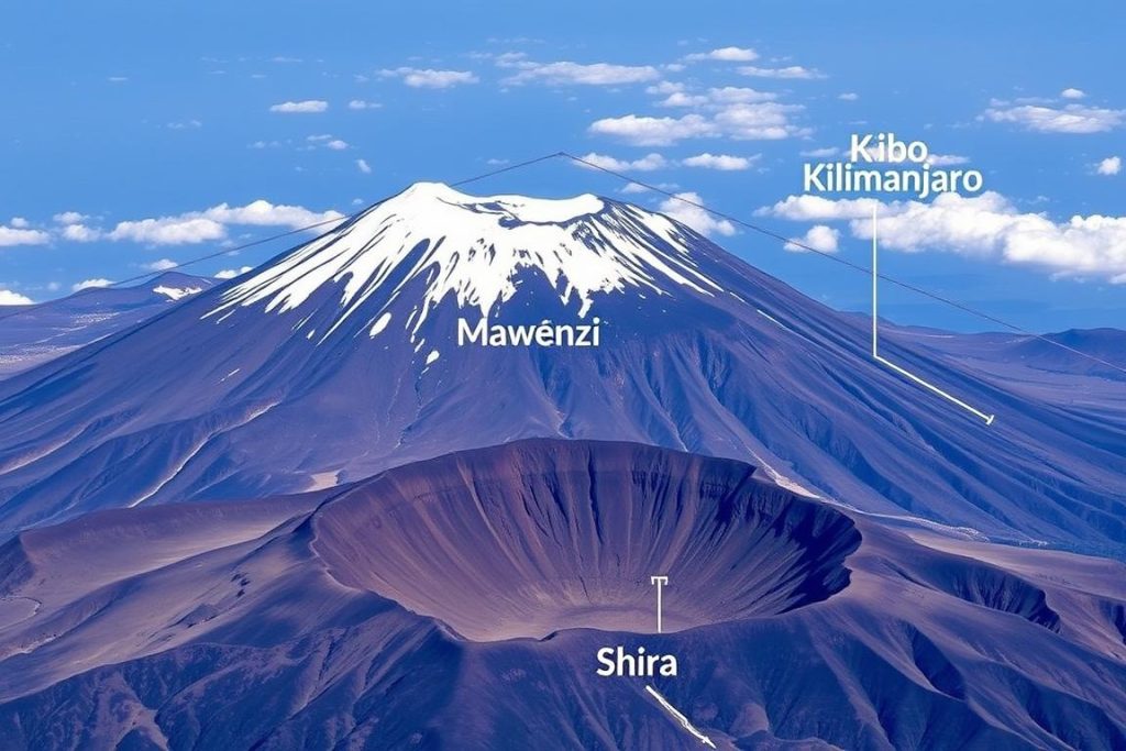
The three volcanic cones of Kilimanjaro: Kibo (center, highest), Mawenzi (right), and the Shira Plateau (left)
The Three Volcanic Cones — what they mean for climbers
Kilimanjaro is a complex stratovolcano made of three main cones. Each cone shapes routes, scenery, and trail conditions:
Kibo
Kibo is the highest cone at 5,895 meters (19,341 feet) and holds Uhuru Peak on its crater rim. Its wide crater—roughly 2.5 kilometers across—contains the inner Reusch Crater and the Ash Pit. Kibo’s upper slopes still retain the mountain’s remaining glaciers and are the location of the final, high-altitude push to the summit (often steep scree and volcanic ash).
Mawenzi
Mawenzi, the jagged, eroded second cone (about 5,149 meters / 16,893 feet), is visually striking but not commonly used for standard summit routes because of its steep, rocky pinnacles. Mawenzi’s ruggedness provides dramatic vistas and is most visible from the eastern and southern approaches.
Shira
Shira is the oldest and lowest of the three (around 3,962 meters / 13,000 feet). Once a cone, it collapsed to form the relatively flat Shira Plateau, which several routes cross early in the climb. The plateau’s wide, open terrain contrasts sharply with the forested lower slopes and the rocky upper reaches of Kibo.
Quick facts
- Highest point: Uhuru Peak (Kibo) — 5,895 m / 19,341 ft
- Second cone: Mawenzi — ~5,149 m / 16,893 ft
- Shira Plateau (filled caldera) — ~3,962 m / 13,000 ft
- Crater diameter (Kibo): ~2.5 km
- Free-standing rise: from ~900 m to 5,895 m
Geological formation and timeline
Kilimanjaro formed along the eastern branch of the Great Rift Valley through multiple volcanic episodes and long-term uplift. Key stages commonly cited in geological literature include:
- Shira as the earliest structure — around 2.5 million years ago
- Mawenzi and Kibo developing roughly 1 million years ago
- The last major eruption approximately 360,000 years ago with minor activity persisting later — Kibo is considered dormant rather than extinct
This volcanic history explains the fertile soils on the lower slopes and the varied terrain climbing kilimanjaro presents: cultivated farmland, dense rainforest, moorland, and finally the barren, high-altitude rocks and ash of the upper cone.
Historical note: first ascent and explorers
The first recorded successful ascent to the summit is attributed to Hans Meyer and Ludwig Purtscheller in 1889, marking a key moment in the mountain’s modern exploration history. Their climb helped establish Kilimanjaro as a destination for mountaineers and adventurers worldwide.
Practical implications for climbers
Geology directly affects route conditions:
- Routes that cross the Shira Plateau start with wide, exposed terrain that can be windy and cold early on.
- Kibo’s scree and ash fields make the final ascent physically demanding, requiring steady pacing for acclimatization and efficient energy use during the ascent and descent.
- Understanding which cone and features your chosen route traverses helps you plan gear (e.g., gaiters for scree) and anticipate terrain changes from forest to alpine desert.
The Journey Upward: Climbing Mt Kilimanjaro
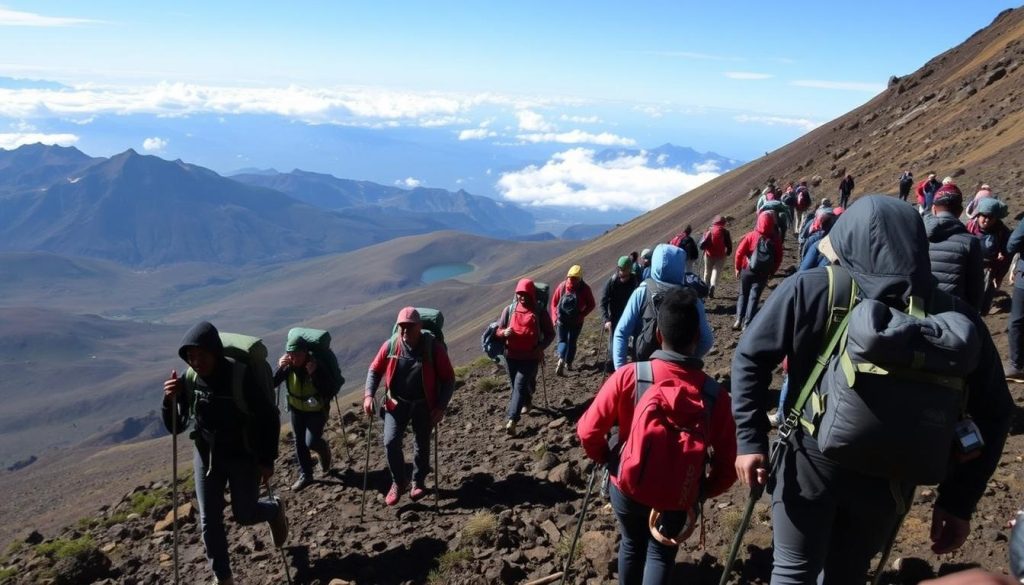
Climbers making their way up the Machame Route, one of the most scenic paths to Kilimanjaro’s summit
Climbing Kilimanjaro is a singular blend of physical challenge and dramatic natural beauty. Because it requires no technical rock or ice climbing—no ropes or harnesses for the standard routes—many fit hikers can attempt to climb mount Kilimanjaro and stand on the roof of Africa. That accessibility has earned the mountain nicknames like “Everyman’s Everest.” Still, altitude is the real obstacle: proper pacing, preparation, and respect for the mountain are essential to reach the summit safely.
Major Routes to the Summit — quick comparison
There are seven commonly used routes to the top, each with distinct advantages. Below is a practical table showing typical duration, difficulty, scenery, summit success and traffic, followed by a one-line “best for” note for each route.
| Route | Duration | Difficulty | Scenery | Success Rate | Traffic |
| Machame | 6-7 days | Moderate–High | Excellent | ~85% (7-day) | High |
| Lemosho | 7-8 days | Moderate | Excellent | ~90% | Medium |
| Marangu | 5-6 days | Moderate | Good | ~75% (6-day) | High |
| Rongai | 6-7 days | Moderate | Good | ~80% (7-day) | Low |
| Northern Circuit | 8-9 days | Moderate | Excellent | ~95% | Low |
| Umbwe | 6 days | Very High | Good | ~60% | Very Low |
| Shira | 6-7 days | Moderate–High | Good | ~85% (7-day) | Low |
Find Your Perfect Kilimanjaro Route
Compare routes by summit success, acclimatization profile, scenery and time. Choose the route that fits your fitness, vacation days, and summit goals.
One-line “best for” tips
- Machame — Scenic and popular; good for 7-day trekkers who can handle steep sections.
- Lemosho — Best balance of scenery and acclimatization; high success for 7–8 day itineraries.
- Marangu — Hut system; shorter option but lower success on 5–6 day schedules.
- Rongai — Northeastern approach; drier and quieter than southern routes.
- Northern Circuit — Longest route with best acclimatization and highest success rates.
- Umbwe — Direct and steep; for experienced hikers seeking challenge over acclimatization time.
- Shira — Crosses the Shira Plateau; scenic and less-crowded starting section.
The importance of acclimatization and altitude
The biggest risk on any kilimanjaro climb is altitude, not technical difficulty. As you ascend, oxygen decreases and the chance of acute mountain sickness (AMS) rises. AMS symptoms range from mild headache, nausea and fatigue to severe, life-threatening conditions: high-altitude pulmonary edema (HAPE) and high-altitude cerebral edema (HACE). Guides and operators prioritize acclimatization because it directly affects summit success.
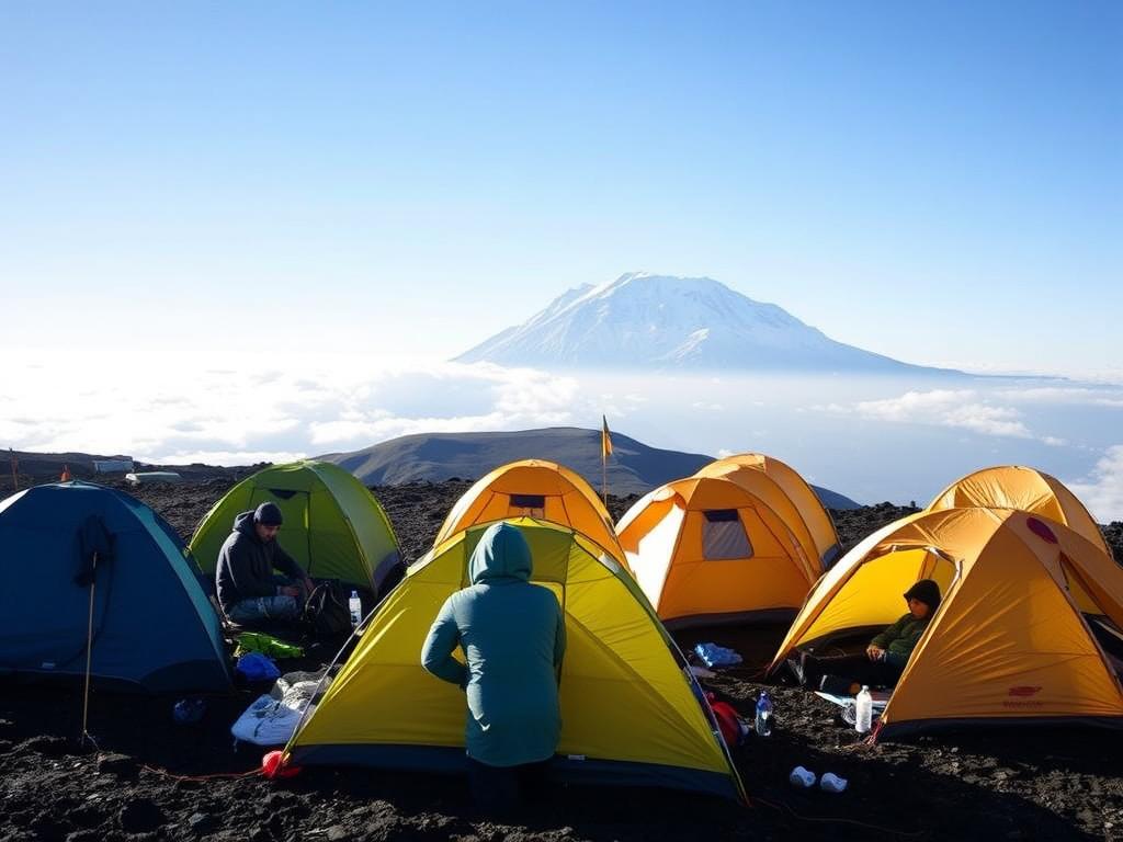
Proper acclimatization at high-altitude camps is crucial for summit success and safety
Use these proven acclimatization strategies to improve your odds of reaching the peak:
- Choose longer routes where possible (7+ days recommended; Northern Circuit and Lemosho are excellent choices).
- Follow “climb high, sleep low” where you gain elevation during the day but return to a lower sleeping altitude.
- Adopt a slow, steady pace—”pole pole” (slowly, slowly) is the local wisdom for a reason.
- Stay well-hydrated; aim for 3–5 liters of fluids per day depending on exertion and weather, and include electrolytes.
- Monitor symptoms carefully, communicate openly with your guide, and be prepared to descend immediately if severe AMS signs appear.
Medical measures sometimes used under physician advice include acetazolamide (Diamox) to help with acclimatization; however, medication is not a substitute for a slow ascent and proper route selection—consult a doctor before using any drug.
Practical safety tips and immediate AMS response
- If a climber shows moderate to severe AMS (confusion, ataxia, breathlessness, severe vomiting), descent is the primary treatment—do not delay.
- Acute Mountain Pulmonary Edema (HAPE) presents with severe breathlessness; immediate descent and medical attention are required.
- Carry a pulse oximeter and have oxygen and emergency evacuation protocols in place with your operator.
- Insurance: ensure you have travel insurance that covers high-altitude rescue and medical evacuation.
Real-life vignette
A 7-day Machame group that paced “pole pole,” added a rest/acclimatization day mid-route, and kept hydration high often experienced higher success than a faster group of similar fitness. The additional time allowed bodies to adjust to reduced oxygen and reduced the chance of AMS during the crucial summit push.
“On Kilimanjaro, the tortoise beats the hare every time. Those who rush face the mountain’s swift judgment; those who respect its pace receive its greatest gift—the summit.”
The Reward: View from Top of Mt Kilimanjaro
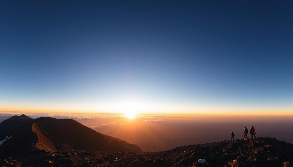
The breathtaking sunrise view from Uhuru Peak, with the crater and glaciers visible in the golden morning light
Reaching Uhuru Peak—the top of Mount Kilimanjaro—delivers one of the most unforgettable summit experiences in the world. Climbers who time the final push to arrive at dawn are rewarded with a panorama that often feels life-changing: a cold, clear horizon, the crater rim underfoot, and the plains of Africa stretching away below. For many, standing on the roof of Africa is the defining moment of a trip and a powerful bucket-list achievement.
The summit night timeline
Most summit attempts follow a similar rhythm. A typical schedule looks like this:
- 23:00–00:30 — Wake, layer up, eat a light snack and begin the ascent from the final camp.
- 00:30–05:30 — Steady, slow ascent through the alpine desert and scree; use headlamps and trekking poles.
- 05:30–07:00 — Arrive at Uhuru Peak around sunrise for photos and short celebration (timing varies by group pace and route).
- 07:00–12:00 — Short summit stay (15–30 minutes), then begin the long descent to lower camps for rest and recovery.
Note: summit times vary by route and weather; guides alter pacing to maximize safety and acclimatization. Plan clothing and equipment for a long, cold night and for sunshine within hours of the summit.
Why summit time is limited
At the top, oxygen is roughly half of what it is at sea level and temperatures can be well below freezing. Prolonged exposure increases the risk of hypothermia and aggravates altitude-related problems. Most guides advise 15–30 minutes at the peak—enough for photos and a brief celebration—before starting the descent, which is often where tired legs and altitude effects meet and require caution.
What you’ll see from Uhuru Peak
From the highest point on Kibo’s crater rim, the view is surprisingly varied:
The crater and glaciers
Below you can peer into Kilimanjaro’s inner Reusch Crater and Ash Pit; Kibo’s crater spans roughly 2.5 kilometers. Small glaciers and permanent ice fields still cling to the rim—though they have dramatically receded over recent decades, their blue-white edges remain a striking contrast to volcanic rock.
The African plains
On clear days the vast savanna stretches to the horizon; you can sometimes see the Kenya–Tanzania border and even Mt Meru about 70 kilometers to the west. The scale and emptiness of the plains make the summit feel wonderfully remote despite the crowds at peak times.
The curved horizon
From nearly 6,000 meters, many climbers report a sense of perspective and the faint impression of Earth’s curvature—a humbling reminder of altitude and distance from the daily world below.
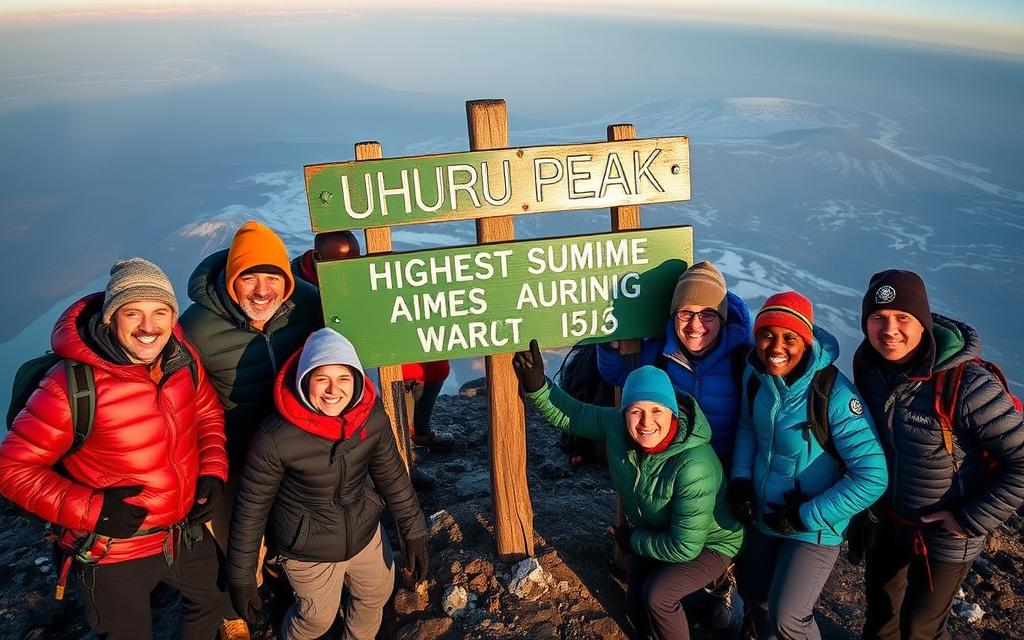
The iconic moment: climbers celebrating their achievement at the Uhuru Peak summit sign
Summit checklist — what to have ready
- Warm summit layers: insulated jacket, down pants, gloves, warm hat, balaclava.
- Headlamp with fresh batteries (and a backup) for the night ascent.
- Small camera with spare batteries (cold drains battery life quickly); consider a phone with a protective case.
- Water and quick-energy snacks; bring a thermos with warm drink if possible.
- Lightweight daypack for summit gear so you can descend hands-free when needed.
- Leave room in your schedule for a 15–30 minute summit stay—don’t plan extended photography sessions beyond that window.
Summit etiquette and photo tips
- Expect crowds at the Uhuru Peak sign—queue briefly and be mindful of others’ summit moments.
- Take wide-angle sunrise photos, close-ups of the crater, and a quick group shot by the summit sign.
- Keep summit celebrations short; extended stays increase exposure risks and limit other climbers’ access.
“CONGRATULATIONS! YOU ARE NOW AT UHURU PEAK, TANZANIA, 5895 M AMSL. AFRICA’S HIGHEST POINT. WORLD’S HIGHEST FREE-STANDING MOUNTAIN.”
Reaching the top of Kilimanjaro is the payoff for careful planning and steady ascent. After the brief summit stay, most groups begin the descent toward lower camps—an often long but joyous return that completes the climb and the ascent–descent cycle that defines the Mt Kilimanjaro experience.
By the Numbers: How Many People Climb Mt Kilimanjaro?
Mount Kilimanjaro has transformed from an obscure explorer’s prize into one of the world’s most popular high-altitude treks. Park figures and operator reports indicate that roughly 30,000–40,000 people attempt Kilimanjaro each year (commonly cited as about 35,000), a number that reflects both growing interest in adventure travel and Kilimanjaro’s reputation as an achievable high-altitude objective.
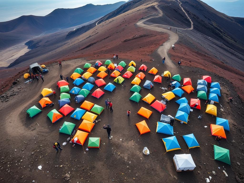
A busy campsite on the Machame Route during high season illustrates Kilimanjaro’s popularity
Success rates — reality check
Exact success statistics vary by source and year, but a reasonable aggregated estimate places overall summit success at roughly 65–70%. Success depends strongly on route choice, trip duration, acclimatization strategy, guide quality and weather.
Route and duration matter more than fitness alone. Aggregated route success examples commonly reported are:
- Northern Circuit (8–9 days): ~95% success — the longest route, with the best acclimatization profile.
- Lemosho (7–8 days): ~90% success — excellent scenery and good acclimatization time.
- Machame (7 days): ~85% success — scenic, popular, strong balance of time vs. success.
- Marangu (5 days): ~50% success — shorter itinerary with less time to acclimatize, lower success on the 5-day option.
Note: these percentages are guides based on park records and operator reporting; year-to-year variation occurs due to weather and visitor mix. When assessing operators, ask how they calculate success rates and request recent, route-specific figures.
What this means for your trip
If you have limited time (5–6 days) and still want a good chance at the summit, select routes and operators with proven short-trip protocols—but be aware the Marangu 5-day option carries lower success. If you can spare 7–9 days, Lemosho or the Northern Circuit significantly increase your odds through better acclimatization opportunities. In short: more days often equals higher summit probability.
Best seasons to climb
Kilimanjaro is climbable year-round, but weather patterns affect both comfort and visibility. Park records and guide experience identify two primary dry windows that offer the most reliable summit-weather:
January to March (short dry season)
Clear skies and generally stable conditions make these months favorable for summit visibility. February is often highlighted for good summit views.
June to October (long dry season)
The longest dry window; July–September are the busiest months on the mountain with consistent summit conditions but higher traffic.
April to May (long rains)
The wettest months, when lower slopes are muddy and trails can be difficult. Crowds thin out and the mountain is very lush, but summit success rates tend to be lower.
November to December (short rains)
A shorter rainy period with variable weather. Early December can offer good conditions before holiday travel peaks.
Maximize Your Summit Success
Want a personalized plan? Use our season planner and route-matching tool to pick the right month and itinerary for your goals and available time.
A World in Microcosm: Mt Kilimanjaro’s Ecological Zones
One of Mount Kilimanjaro’s most remarkable features is the rapid progression through five distinct ecological zones. Climbers experience a sequence of habitats—from cultivated lowlands to arctic-like summit conditions—in the span of days, making each climb a compressed environmental journey across mountain, moorland and ice.
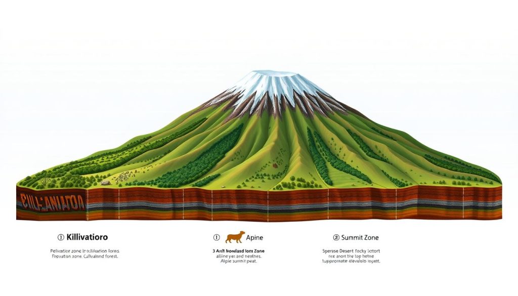
The five distinct ecological zones of Mt Kilimanjaro, showing the dramatic transition from tropical to arctic environments
The Five Zones — what to expect on the trail
Cultivation Zone (800m–1,800m)
What to expect: warm, cultivated slopes with coffee and banana farms, villages and busy local life. Temperatures are comfortable and humidity is high.
Practical tip: Light clothing is fine here; use this zone to double-check gear and acclimatize to travel fatigue.
Notable features: coffee plantations, terraced farms, Chagga villages
Rainforest Zone (1,800m–2,800m)
What to expect: dense montane forest, moss-draped trees, frequent mist and rich biodiversity. Trails are cooler and often muddy after rains.
Practical tip: Bring a waterproof layer and quiet patience — birding is best here (140+ bird species) and sightings of colobus and blue monkeys are common.
Notable features: colobus monkeys, tree ferns, abundant birdlife
Heath / Moorland Zone (2,800m–4,000m)
What to expect: open moorland dotted with giant lobelias and the prehistoric-looking giant groundsel (Dendrosenecio kilimanjari). Temperatures drop and the air dries out compared to the rainforest below.
Practical tip: Layering becomes important; mornings can be chilly and daytime sun strong. Look for unique flora that survives at these elevations.
Notable features: giant groundsels, erica shrubs, other high-altitude plants
Alpine Desert Zone (4,000m–5,000m)
What to expect: sparse vegetation on volcanic scree, strong sun, large diurnal temperature swings and thin air. This is a demanding stretch for acclimatization and energy management.
Practical tip: Use sun protection and conserve energy—this zone often precedes the final high camp and summit push.
Notable features: dramatic rock formations, wide views, minimal plant life
Arctic Zone (5,000m–5,895m)
What to expect: polar-like conditions with snow, ice and strong winds. Oxygen is roughly half that at sea level and temperatures can plunge well below freezing.
Practical tip: Summit clothing and cold-weather gear are essential; limit time on the summit for safety.
Notable features: glaciers, Kibo crater rim, spectacular sunrise views
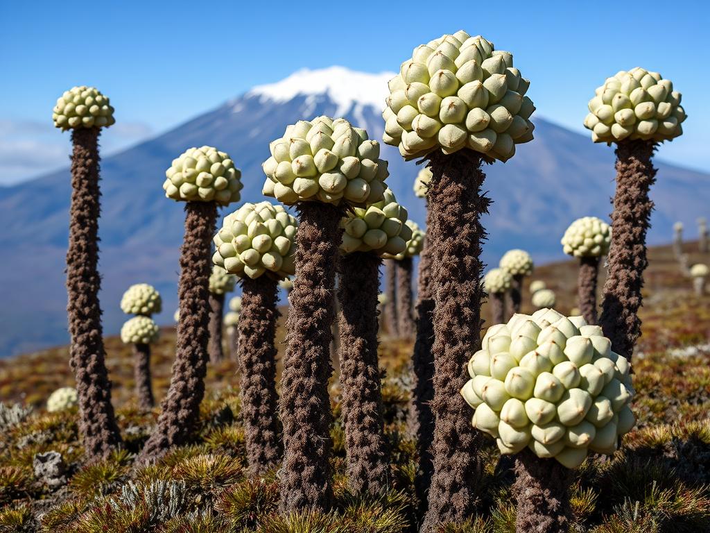
The otherworldly giant groundsels (Dendrosenecio kilimanjari) are endemic to Kilimanjaro’s moorland zone
Unique flora and fauna
Kilimanjaro supports around 1,200 vascular plant species and diverse wildlife concentrated in the lower zones. Highlights include colobus and blue monkeys in the rainforest, over 140 bird species (ideal for birdwatching in the forest zone), endemic small mammals like the Kilimanjaro shrew, and high-elevation specialists such as unique chameleons.
- Look for colobus monkeys and colorful Hartlaub’s turaco in the rainforest.
- Giant groundsels and lobelias define the moorland landscape and are photographic favorites.
- Occasional sightings of elephants or buffalo may occur in lower forested areas—always observe from a distance.
How zones affect your climb
Transitioning between zones affects trail conditions and your acclimatization: muddy, root-strewn paths in the rainforest give way to open, wind-exposed moorland and then to the dry scree of the alpine desert. Each shift requires small gear and pacing adjustments—waterproofs and gaiters in the forest, sun protection in moorland, and heavier insulation for the arctic zone and summit.
Conservation note: changing glaciers and ecosystems
Kilimanjaro’s glaciers and permanent snow have noticeably retreated over recent years due to climate change. While small icefields still cling to Kibo’s rim, their shrinkage impacts local hydrology and the visual character of the summit. Climbers and operators are encouraged to support conservation initiatives and respect park regulations to help protect this unique mountain environment for future generations.
Preparing for the Challenge: How to Climb Mt Kilimanjaro Successfully
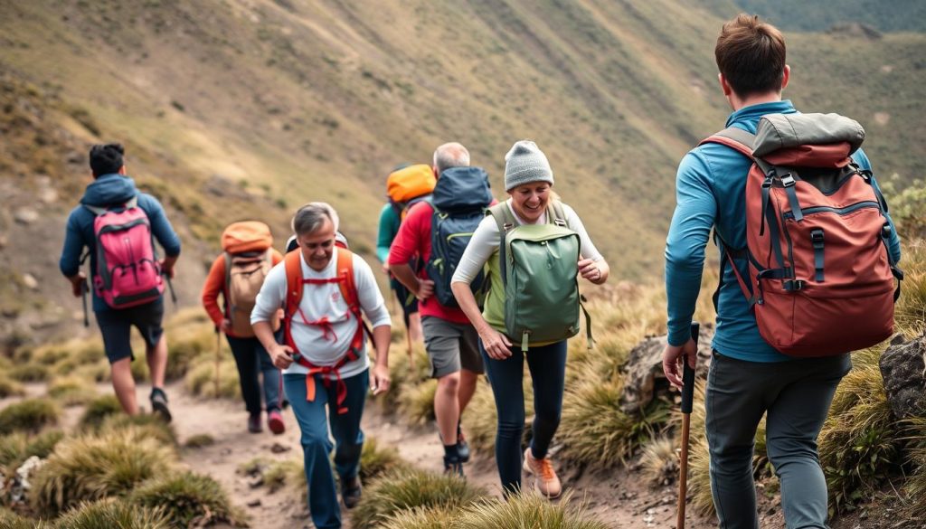
Physical preparation with loaded backpacks on steep trails helps simulate the demands of climbing Kilimanjaro
Successful climbing Kilimanjaro begins long before arrival in Tanzania. A multi-pronged preparation plan—physical conditioning, altitude readiness, the right gear, and a vetted guide—greatly increases your chances of reaching the summit and enjoying the trip safely. Below you’ll find a practical training timeline, gear guidance tailored to each ecological zone, and clear criteria for choosing a reputable operator.
12-week sample training plan (overview)
Start a structured program 12 weeks out if possible. The aim is to build endurance, strength and joint resilience while including specific altitude-conditioning where feasible.
- Weeks 1–4: Base-building — 3 cardio sessions per week (running, cycling, stair climber), plus two lower-body strength sessions (squats, lunges). One long hike per weekend with a light pack.
- Weeks 5–8: Load progression — increase long-hike distance and add a loaded backpack (10–15 lbs). Continue strength work and add interval sessions for VO2 improvement.
- Weeks 9–12: Specificity — prioritize back-to-back long hikes, stairs with load, and trekking poles practice. Include one simulated multi-day trek if possible. Taper the final week before travel.
Cardiovascular, strength and altitude preparation
Cardiovascular
- Hike, run or cycle 3–4 times weekly; increase long-hike time to 5–8 hours.
- Incorporate stair or step-machine sessions to mimic elevation gain.
Strength & balance
- Two weekly sessions: squats, lunges, deadlifts variations, core work and single-leg balance exercises.
- Practice carrying a loaded daypack and using trekking poles to offload knees.
Altitude-specific
- Train at elevation if possible, or use stair sessions and intermittent hypoxic training as advised by a physician.
- Breathing exercises and intermittent interval training improve oxygen efficiency.
“The summit is what drives us, but the climb itself is what matters. The journey of Kilimanjaro begins not on the mountain, but in the months of preparation that shape both body and mind for the challenge ahead.”
Essential gear — pack by zone
Mt Kilimanjaro’s multiple climate zones mean you need gear that covers tropical heat to arctic cold. Below is a practical packing breakdown with key items highlighted.
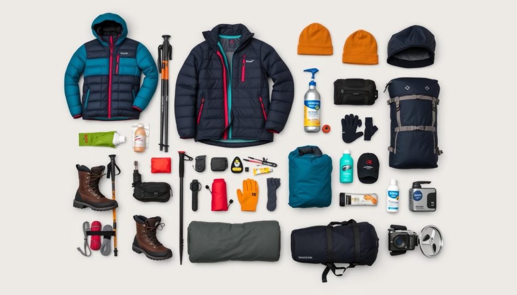
Essential gear for a Kilimanjaro climb includes proper layering systems for multiple climate zones
Clothing
- Moisture-wicking base layers (bring spares)
- Insulating mid-layers: fleece and down jacket (down jacket recommended for summit night)
- Waterproof, breathable shell (jacket and pants)
- Warm hat, balaclava, insulated gloves + thin liner gloves
- Convertible hiking pants and moisture-wicking socks
- Light clothing for lower zones (cultivation and rainforest)
Footwear & equipment
- Broken-in, waterproof hiking boots (ankle support)
- Gaiters for scree and dust protection
- Trekking poles (highly recommended for knees and pace)
- Headlamp with spare batteries; small personal first-aid kit
- Sleeping bag rated for at least -10°C (consider colder rating if you are sensitive to cold)
- Daypack (30–35L) and water-carrying system (3L capacity)
Hydration and nutrition
Consistent hydration is essential to reduce altitude sickness risk. Aim for 3–5 liters of fluids daily depending on exertion, weather, and altitude. Use electrolyte supplements to replace salts. Purification systems (tablets or filters) are useful for side trips; most operators provide boiled/warm water at camps.
Practical packing & zone advice
- Pack light for the day: summit day requires only essential layers in your daypack; porters carry the rest.
- Waterproofs and gaiters are most useful in the rainforest; sun protection (hat, sunglasses, sunscreen) is crucial from moorland upward.
- Bring spare batteries and keep electronics close to your body to preserve battery life in cold.
Get Your Complete Kilimanjaro Packing List
Download a printable packing checklist and zone-by-zone clothing guide tailored to your chosen route and season.
Choosing a tour operator and guide — what matters
Selecting the right kilimanjaro guide and operator is one of the most important decisions you’ll make. A quality operator provides experienced guides, medical protocols, and ethical treatment of porters.
- KPAP (Kilimanjaro Porters Assistance Project) membership or clear porter welfare policies
- Guides with Wilderness First Responder or equivalent training
- Oxygen and medical supplies carried on treks; clear emergency evacuation protocols
- Transparent pricing, small group sizes (ideally 8–10 climbers max), and positive recent reviews
What to look for
- Significantly underpriced trips with vague itinerary or equipment lists
- No mention of porter care, inadequate group-to-staff ratios, or no emergency evacuation plan
- Poor communication before booking or no proof of guide training
Red flags
Tip: ask operators for a sample itinerary that includes acclimatization days, specifics about porter pay and weight limits, and recent client references. Expect reputable companies to charge in the typical range of $1,800–$3,000 for a quality climb depending on route and inclusions—very low prices often mean cut corners.
Altitude sickness, medical prep and safety
Altitude sickness (acute mountain sickness) is the primary medical concern. Symptoms include headache, nausea, fatigue and sleep disturbance. Severe forms—HAPE (high-altitude pulmonary edema) and HACE (high-altitude cerebral edema)—are life-threatening and require immediate descent and medical care.
- Preventive steps: choose an acclimatization-friendly route, follow “climb high, sleep low,” pace yourself “pole pole,” and hydrate consistently.
- Medications: acetazolamide (Diamox) can aid acclimatization but consult your physician before use; it is not a substitute for slow ascent.
- Field tools: carry a basic first-aid kit, a pulse oximeter (useful to monitor oxygen saturation), and ensure your operator carries oxygen and evacuation plans.
- Insurance: purchase travel insurance that explicitly covers high-altitude rescue and helicopter evacuation for the planned maximum altitude.
Ascent, descent and contingency planning
Plan for both ascent and descent: many summit failures and accidents occur during descent when fatigue and residual altitude effects combine. Ensure your itinerary includes reserve days for weather, clear communication plans, and that your guide has authority to alter plans for safety.
Finally, prepare mentally: the climb is long, often cold, and requires patience. Respect the mountain’s pace, support your teammates, and listen to your guides—the combination of careful physical training, sensible acclimatization and a reputable guide gives you the best chance to climb mount kilimanjaro and return home with the summit memory intact.
The Cultural Significance of Mt Kilimanjaro
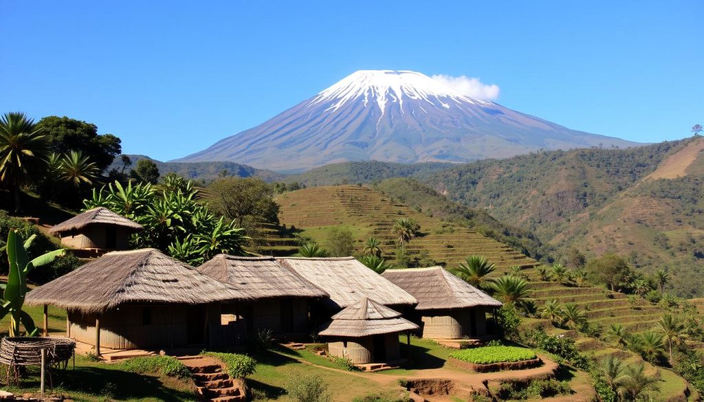
Traditional Chagga settlements on the lower slopes of Kilimanjaro, where the mountain has shaped culture for centuries
Beyond its physical presence, Mount Kilimanjaro carries deep cultural weight for Tanzania and for mountain africa as a whole. The massif has shaped local identity, agricultural practices, myth and ritual for centuries, while also becoming an international symbol of African natural heritage and aspiration.
The Chagga people and Kilimanjaro
The fertile southern and eastern slopes are home to the Chagga, a people known for their sophisticated irrigation, terracing and coffee cultivation. For generations the Chagga have adapted farming to the mountain’s microclimates, producing crops that support local communities and a thriving agricultural economy.
In Chagga storytelling, Kilimanjaro frequently appears as a sacred presence. One traditional tale involves the deity Ruwa and a figure named Tone; such stories link landscape features to human origins and local moral lessons, reinforcing the mountain’s role as both a living landmark and a cultural teacher.
The name “Kilimanjaro” has multiple proposed etymologies—some translate to “shining mountain” or “white mountain” in reference to its snow-capped top, others suggest “mountain of caravans” or “mountain of greatness.” The exact origin remains debated, but the name’s resonance is universal.
Historical footnote and early explorers
Modern, recorded exploration of the mountain culminated when Hans Meyer and Ludwig Purtscheller reached the summit in 1889—an achievement that helped open Kilimanjaro to later climbers and scientific study and that remains a milestone in the mountain’s modern history.
National symbol and global icon
“We will light a candle on top of Mount Kilimanjaro which will shine beyond our borders, giving hope where there is despair, love where there is hate, and dignity where before there was only humiliation.”
Since independence, Kilimanjaro has featured on stamps, currency and national imagery, becoming a potent emblem of Tanzanian identity. Kilimanjaro National Park was established in 1973 and UNESCO named the mountain a World Heritage Site in 1987, recognizing both its ecological value and cultural significance.
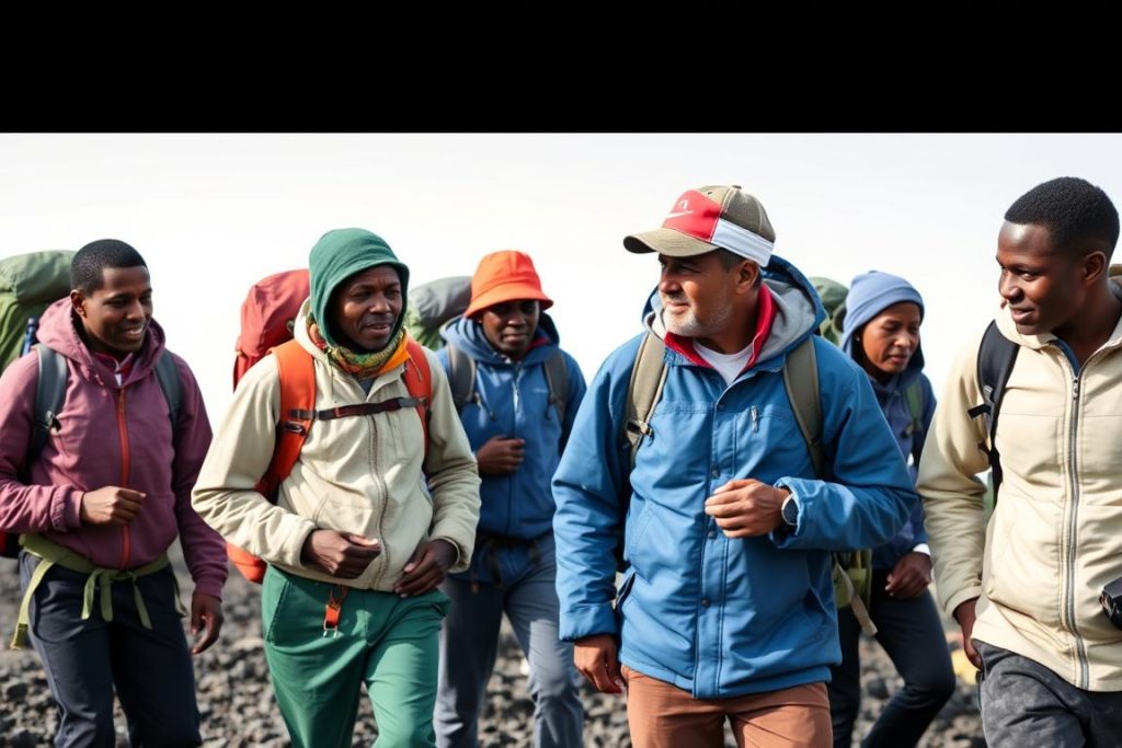
Local guides and porters, many from the Chagga community, share their knowledge and culture with international climbers
Economic impact and ethical tourism
Kilimanjaro tourism supports thousands of people—guides, porters, cooks and lodge staff—and is a crucial economic engine for the region. Typical climbs employ multiple support staff per climber, creating broad local employment and downstream benefits for hotels, transport and local vendors.
That dependence on climbing income has also driven attention to ethical tourism. Organizations such as the Kilimanjaro Porters Assistance Project (KPAP) advocate for fair wages, safe loads, proper equipment and improved working conditions for porters. When choosing an operator, prioritize those who demonstrate clear porter welfare policies, transparent pricing and KPAP membership or equivalent standards.
Ethical tourism checklist
- Ask operators about porter pay, maximum loads and provision of proper boots and jackets.
- Prefer companies with KPAP membership or documented porter welfare commitments.
- Tip fairly and follow local guidance on appropriate gratuities; consider shared porter-focused donations if recommended.
- Support local businesses in Moshi and on approach days to maximize economic benefit to communities.
Respectful engagement—learning a few Swahili phrases, listening to guide stories, and supporting ethical operators—deepens the cultural exchange and ensures your trip helps sustain the mountain’s communities for years to come.
The Call of Mt Kilimanjaro: Your Journey Awaits
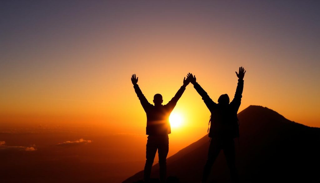
The triumph of Kilimanjaro remains one of life’s most profound achievements—a moment when human determination meets natural majesty
Mt Kilimanjaro is more than Africa’s highest peak; it’s one of the world’s most accessible great adventures. Unlike highly technical mountaineering objectives, climb mount Kilimanjaro is achievable for many fit hikers with proper preparation, the right guide, and respect for altitude. The mountain’s mix of ecosystems, drama and cultural richness makes climbing kilimanjaro a trip that changes how people see themselves and the world.
The ascent and descent together form the full experience: challenging, humbling, and ultimately rewarding. Those who reach Uhuru Peak often return home with more than a summit photograph—they carry a renewed sense of perspective and accomplishment that lasts long after the climb.
Start here — 3 practical first steps
- Pick a route: decide how many days you have and match it to a route (7–9 days increases odds; Northern Circuit and Lemosho are acclimatization-friendly).
- Book a reputable guide: prioritize KPAP-aware operators, trained guides, and clear medical/evacuation protocols.
- Begin a training plan: start a 12-week program that builds cardio, strength and altitude readiness; download a sample plan to get started.
Remember “pole pole”—slowly, slowly. The mountain rewards patience. Take altitude seriously: monitor for mountain sickness, follow acclimatization advice, and be prepared to descend if symptoms worsen. With sensible planning and a trusted guide, you can maximize your odds of a safe summit and a meaningful journey.
Begin Your Kilimanjaro Journey
Download our Complete Kilimanjaro Guide now for a step-by-step training plan, a printable packing list, route selection help, and a summit safety checklist to reduce mountain sickness risk and boost your summit probability.